Very early into my college career I took an introductory GIS course. During this course I learned how to comfortably use ArcGIS by ESRI. I would love to continue utilizing and practicing this software but unfortunately as of now I have not been able to attend another GIS course. However, I do plan on getting my certificate eventually and thanks to the introductory course I took I am confident I will be able to quickly learn more advanced skills in the software.
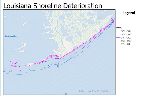
My final project was on the deterioration on Louisiana’s shoreline. This has been a known issue in the area, but exactly how much the land was subsidizing was unknown. I created a map that allows viewers to easily see how much the shoreline has retreated over the last couple hundred years. I wanted to choose an environmental crisis for this project so I could strengthen my research skills in this field.
If you have any questions regarding this particular topic, please feel free to email me as I am confident I can answer most of them!
